2021 Drill Program
In Spring 2021 Riverside and partner, Carlyle Commodities Corp. completed the Phase I Drill campaign. The program consisted of a total of seven (7) drill holes.
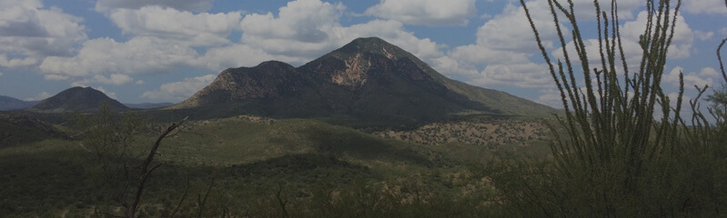
Image: Progressing towards drilling. Drill pad preparation at the Cecilia Project
North Breccia Target
Anomalous gold mineralization was intersected in all seven drill holes, with the best intercepts being 24.2 m of 1.51 g/t Au starting from only 2.30 m downhole at the North Breccia Target (CED21-005) and in hole CED21-006 from 106.7 to 110 which retuned 3.7 g/t over a true width of 3.3 m. A further 8.9 m of 0.64 g/t Au intercept was cut near end-of-hole starting from 40.35 m. Assays remain pending for another slightly deeper drill-hole at the North Breccia Target (See 3D Figure below). This first phase drill campaign included mostly shallow drill-holes, which successfully demonstrate a well-developed hydrothermal system near surface, with significant room to extend mineralization both laterally and to greater depths with subsequent drilling.
Table 1: First assays received from the North Breccia drilling, including two intercepts. Summary of additional results are listed further below in table 2.
| Hole_ID | From (m) | To (m) | Interval (m) | Grade (g/t Au) |
| CED21-005 | 2.3 | 26.5 | 24.2 | 1.51 |
| CED21-005 | 40.35 | 49.25 | 8.9 | 0.64 |
| including | 43.95 | 47.25 | 3.3 | 1.32 |
| CED21-006 | 106.7 | 110 | 3.3 (True width) | 3.7 |
| including | 106.7 | 108 | 1.3 (True width) | 8.82 |
Notes: Cut-off grade used for calculating intervals is 0.2 g/t Au. All reported intercepts are downhole lengths (estimate true width will be determine with the hole CED21-006, for which logging indicate a zone of interest of about 4 meters.
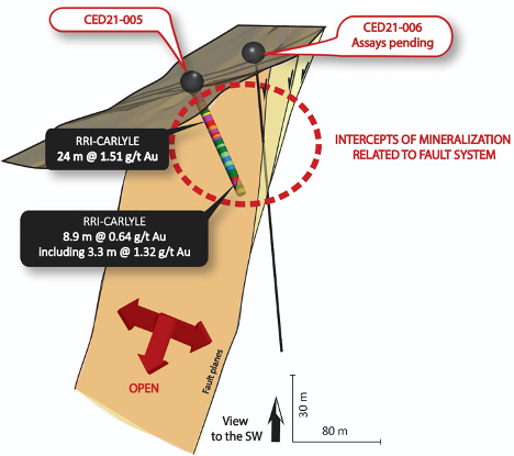
Figure: 3D section of the drilling at North Breccia target from Riverside and Carlyle exploration program. Hole 005 has intersected the fault system and shows extent of mineralization with relation to the fault system. Mineralization corresponds to a combination of breccia, fault and strong silicification.
The first drill program from Riverside and Carlyle was focused on targeting the hydrothermal system identified at two principal elevations: 2,200 m and 1,900 m, respectively corresponding to the San Jose Target and the North Breccia Target. By doing so, Riverside’s team was able to test the continuity of the mineralized structures at shallow depth.
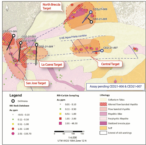
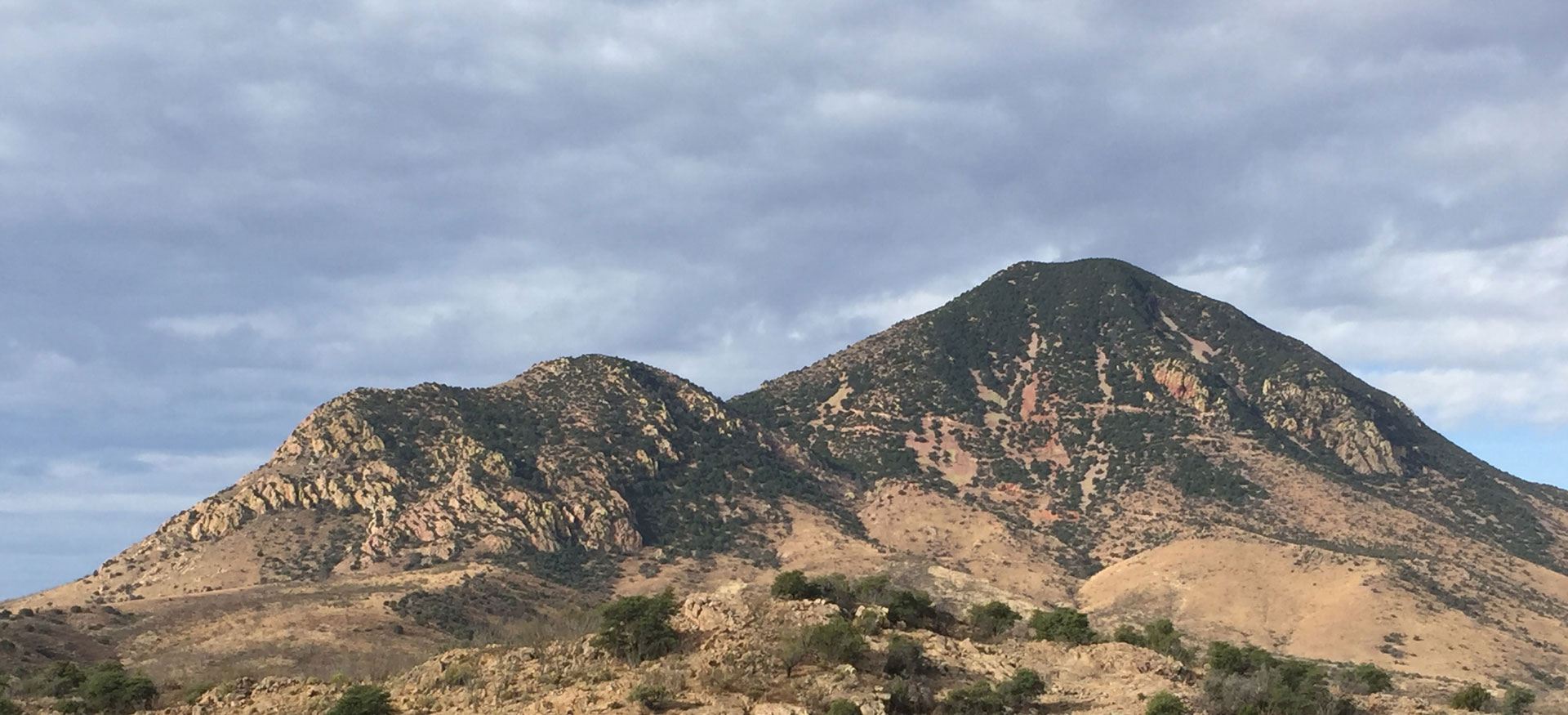
Figure: Simplified map of the Cerro Magallanes eastern slope with the first phase drill program
The San Jose Target
A total of 3 holes were drilled into the San Jose Target (CED21-001, 002, 003) and 1 hole (CED21-004) to test the La Cueva Target identified as the northeastern structural junction with the east-west Agua Prieta structural corridor including the North Breccia Target and the Central Target as shown in Figure 2.
The San Jose Target was originally identified from a historical working that included extensive tunnels up to 80 m deep and stopes, for which the extent is not known. Previous sampling taken from the stope wall during 2020, returned high grades up to 48 g/t Au in a sawcut channel sample over 0.75 m. Results from drilling show a wide interval of lower grade enveloping high-grade pods at shallow depths. The drilling at San Jose finds extensive and intensive silicification which appears to be the upper zones of low sulfidation epithermal fluids which could be the upper distal outflows from potentially gold rich veins below. This type of alteration is found in other epithermal centers in Sonora, Mexico and the results so far are favorable for this target.
Drill core shows the mineralized zone identified in the drill holes is primarily concentrated within fault zones and is associated with moderate to intense silicification. The fault system extends to depth and so far, appears to become a lot wider which is also reflected in the grade thicknesses. The San Jose target was never drilled prior to this program. Drilling so far suggests the structures are widening at depth and warrant additional drilling.
| Hole_ID | From (m) | To (m) | Interval (m) | Grade (g/t Au) |
| CED21-001 | 19.5 | 21 | 1.5 | 0.21 |
| CED21-001 | 38.15 | 39 | 1.3 | 0.69 |
| CED21-002 | 31.15 | 32.2 | 1.05 | 0.49 |
| CED21-002 | 91.25 | 97.2 | 5.95 | 0.2 |
| CED21-003 | 42.85 | 45.95 | 3.1 | 0.52 |
| CED21-003 | 50.1 | 54.5 | 4.4 | 0.23 |
| including | 54 | 54.5 | 0.5 | 0.91 |
| CED21-003 | 89.55 | 99 | 9.45 | 0.23 |
| CED21-003 | 114.15 | 116.3 | 2.15 | 0.26 |
| CED21-003 | 118.75 | 120.75 | 2 | 0.39 |
| CED21-003 | 122 | 123 | 1 | 0.55 |
| CED21-003 | 154 | 157.45 | 3.45 | 0.35 |
| CED21-004 | 11.4 | 15.7 | 4.3 | 0.29 |
| CED21-004 | 45.45 | 51.7 | 6.1 | 0.43 |
| including | 47.4 | 48.35 | 0.95 | 1.09 |
| CED21-004 | 82.2 | 85.2 | 3 | 0.87 |
| CED21-004 | 116.2 | 117.05 | 0.85 | 1.08 |
| CED21-005 | 2.3 | 26.5 | 24.2 | 1.51 |
| CED21-005 | 40.35 | 49.25 | 8.9 | 0.64 |
| including | 43.95 | 47.25 | 3.3 | 1.32 |
| CED21-006 | 34.5 | 40.15 | 5.65 | 0.39 |
| including | 34.5 | 36.5 | 2 | 0.78 |
| CED21-006 | 47.5 | 49 | 1.5 | 0.6 |
| CED21-006 | 70.2 | 70.7 | 0.5 | 0.2 |
| CED21-006 | 106.7 | 110 | 3.3 (True width) | 3.7 |
| including | 106.7 | 108 | 1.3 (True width) | 8.82 |
| CED21-007 | 35.35 | 37.65 | 2.3 | 0.19 |
| CED21-007 | 45.75 | 48.9 | 3.15 | 0.31 |
| CED21-007 | 60.75 | 63.8 | 3.05 (True width) | 0.67 |
| including | 62.3 | 63.8 | 1.5 (True width) | 1.18 |