Phase 1 Sampling Program:
The ongoing Phase 1 exploration program through November 2020 under the Carlyle-option has delivered additional data, which includes:
- First results from the initial batch of 21 rock channel samples collected from Cerro Magallanes that returned: 43.2 g/t Au, 5.6 g/t Au and 2.5 g/t Au (see Table 1 below);
- Channel sampling results collected at San Jose Target yielding 48.3 g/t Au over 0.75 m (see Table 2 below);
- Results from soil sampling at the Casa de Piedra target within the sedimentary Cabullona group;
- Results from Aster processing highlighting altered corridors across the district scale property;
- Topographic DEM produced from drone survey
Table 1: Top Four (4) of 21 Gold Assay Results from Current Channel Sampling Program with Carlyle
| Sample # | Au (ppm) | Target |
| RRI-6038 | 43.2 | San Jose |
| RRI-6034 | 5.6 | San Jose |
| RRI-6046 | 2.5 | North Breccia |
| RRI-6047 | 1.08 | North Breccia |
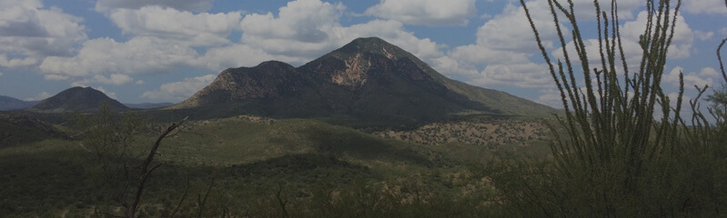
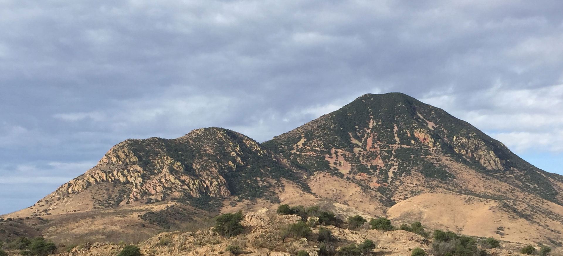
Exploration at Cerro Magallanes Target:
Phase 1 exploration has defined and confirmed extensive high-grade mineralization on surface at the San Jose and North Breccia targets as highlighted in Figure 7 below. The latest sampling returned 43.2 g/t Au and 5.6 g/t Au from part of a more extensive structural corridor for which historical work has defined over 300 m in strike length and 20 m in width. Sampling in 2017 by Riverside from a mine dump area returned samples of 133.7 g/t Au and 58 g/t Au. Current interpretation suggests a potential intersection at depth of the San Jose and North Breccia structures identifying possible bonanza style mineralization.
Table 2: Sample results from the November 10th channel sample batch at San Jose target
| Sample # | Au (ppm) | Target | Channel Thickness | Rock Type |
| RRI-32975 | 48.3 | San Jose | 0.75-m channel | Underground silicified fluidal rhyolite |
| RRI-32997 | 0.86 | San Jose | 1.70-m channel | Silicified breccia |
| RRI-32976 | 0.78 | San Jose | 0.85-m channel | Underground silicified breccia |
| RRI-32978 | 0.66 | San Jose | 1.60-m channel | Silicified breccia |
| RRI-32974 | 0.66 | San Jose | 0.80-m channel | Underground silicified breccia |
| RRI-32998 | 0.56 | San Jose | 1.25-m channel | Silicified fluidal rhyolite |
Channel samples yielding up to 48.3 g/t Au over 0.75 m at the San Jose Target (see Table 1 above). The 36-sample batch with over 43% of the gold assays higher than 0.2 g/t Au. All samples were collected using a hand saw to ensure continuity and thickness of reported grade-intervals. This latest batch of samples is from brecciated and silicified rhyolite from underground workings as well as at surface, which collectively form part of the La Cueva structural corridor parallel to the main San Jose fault.
By incorporating surface data and geophysics survey (Magnetic and Induce Polarization), Riverside’s geologists were able to provide a better understanding of the structure for targeting of the mineralization. Hosts and feeder zones of the mineralization throughout the rhyolitic dome is controlled by both northwest and northeast structural corridors. Mapping and sampling have delineated a 600-m long high-grade zone open along trend, called the Agua Prieta structural zone (see Figure 1B below). The trend is notable by its reddish-oxide stained rocks outcropping prominently along the eastern slope of the dome. Intersections between feeders and dome margins, as indicated by the magnetic survey correlate with the Central and North Breccia targets.
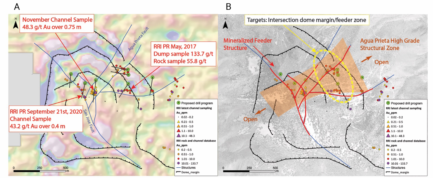
Figure 7: Maps of the Cerro Magallanes dome including interpretation of the dome margin and simplified structures. Proposed drill holes are subject to adjustments. Figure 1A - 1DV magnetic survey results with the drill plan and Riverside’s rock and channel sampling; Figure 1B - Target interpretation and mineralized feeder system.
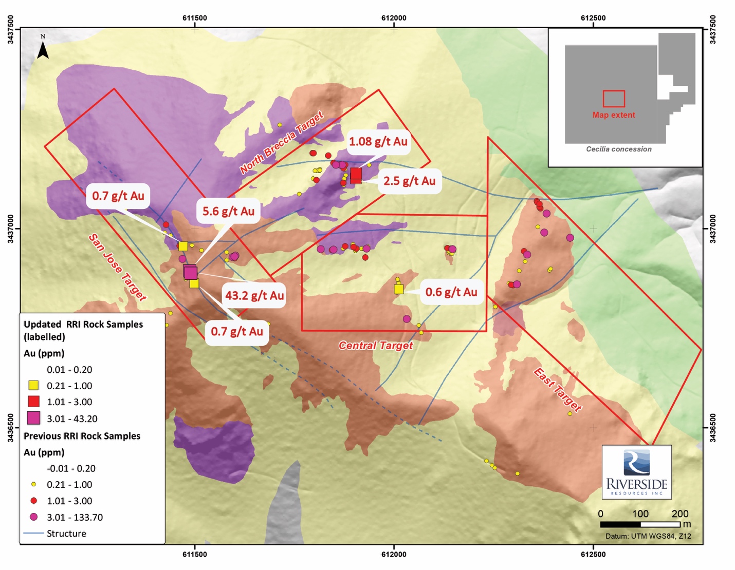
Figure 8: Simplified Geological Map Including Recent RRI Channel Sampling
Mineralization at the San Jose target consists of grey quartz, opalescent silica, fluorite and silicification within structural breccia and upper dome shears. The primary structure is oriented northwest along which conjugated structures form sets of northeast and easterly oriented faults. It is interpreted that the primary fluid path for mineralizing fluids follows a northwestern lineament, which allows ore shoot deposition of gold and silver mineralization at fault intersections as well as along dome margins.
The North Breccia, Central and East targets are associated with increases in precious and base metals, showing boiling textures and dissolution of clasts. These indicators make us believe that historical drill holes and recent surface work could define a shallow horizon (upper levels) within an epithermal system.
Exploration at district scale:
New data from soil sampling and Aster processing show a corridor of alteration following northwest and northeastern oriented structures as shown in the figure below. In addition, widespread gold-bearing quartz veins with gold values up to 12.5 g/t Au confirm the presence of fluid migration throughout the property and especially along northeastern structures. The divergence in orientation of the northwestern Cerro Magallanes primary fluid migration path and the northeastern trend outside of the dome could be explained by difference in rheology for which the rhyolite dikes act as an aquiclude in the sedimentary units. This interpretation has helped guide target definition (see Figure 9 below).
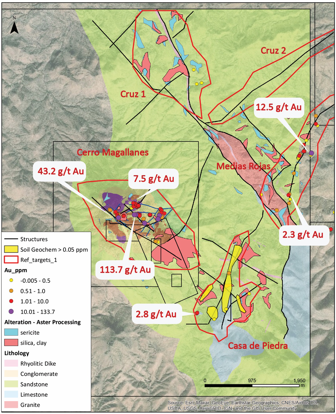
Figure 9: District Scale Targeting Refined Using Aster Processing, Soil Sampling and Historical Rock Sampling