OVERVIEW
| Commodity: | Gold |
| Deposit Type: | Orogenic gold deposits |
| Location: | Ontario, Canada |
| Size: | 600 Hectares |
| Status: | Available for Option |
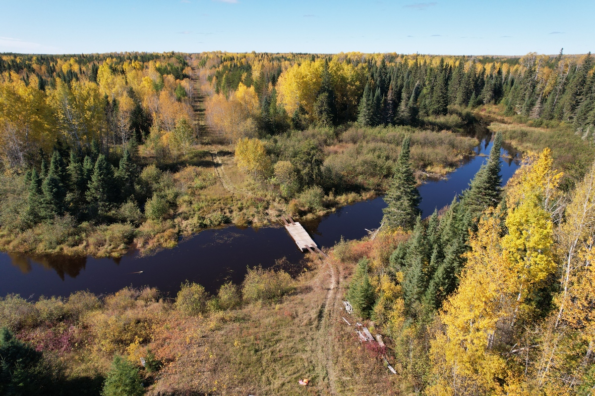
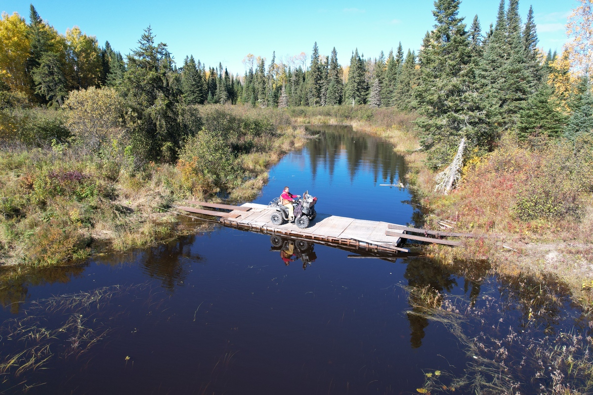
The Duc Project (“the Project”) is located south of the town of Kapuskasing, within the Porcupine Mining District and is roughly 600 hectares in size. The area has excellent infrastructure, with road access from the Trans-Canada Highway and only 10km from the past-producing Agrium Ltd. Phosphate Mine. The Project also has nearby existing power and within a 40-minute drive from the town of Kapuskasin, which has a population of 8,300.
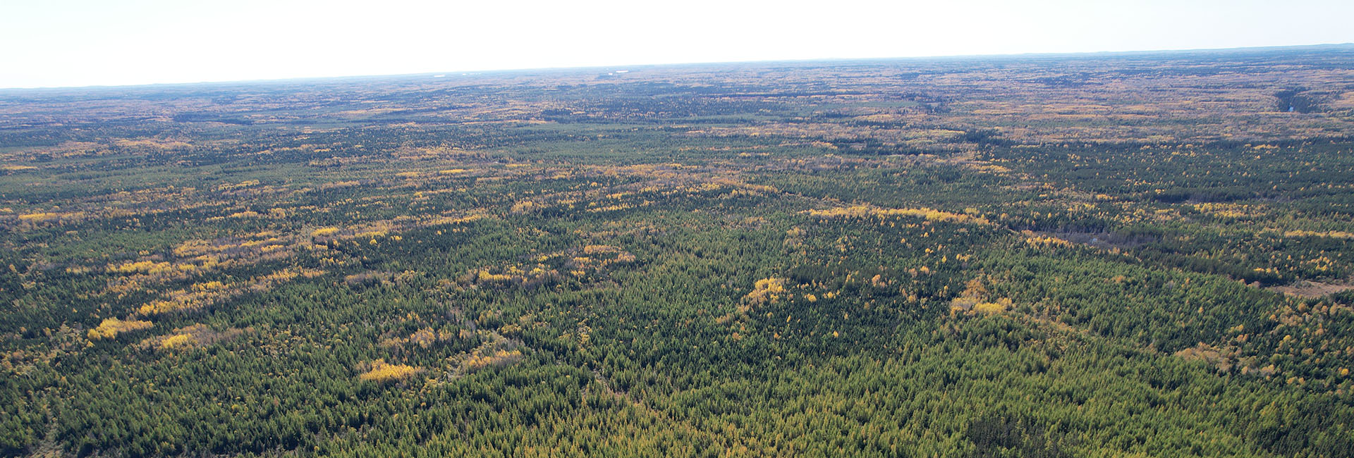
Interest in Ontario’s critical minerals sector has attracted new explorers to this region, which in our opinion can open up this area further to development through its rare earth element potential, along with the known gold endowment. The DUC property comprises flat to undulating terrain with up to 20m of relief in some areas. The project area is clear-cut logged in the 1980s.
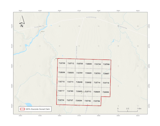
FIGURE 1 MAP OF THE DUC CLAIMS SOUTH OF KAPUSKASING AND TRANS CANADA HIGHWAY, 10KM WEST ON ECCLESTONE ROAD FROM AGRIUM INC. DEACTIVATED PHOSPHATE MINE
Project History
Prior to 1987, there was minimal exploration work conducted by mining companies in the area. In 1965, Kenogamissis Gold Mines Ltd. conducted ground magnetic and electromagnetic surveys in a small portion of the mining claims. Only one diamond drilling program took place, with two holes located on the mineral claims.
In 1987, Golden Trio Minerals Ltd. conducted an airborne magnetic and electromagnetic survey covering large areas, including the mineral claims. The survey detected several conductors, which were also identified in a previous airborne geophysical survey published by the Ontario Geological Survey in 1986. These conductors formed a zone that ran roughly east to west and correlated with an elongated magnetic high.
Following the geophysical work, Golden Trio drilled 18 reverse circulation overburden holes on the DUC claims as part of a larger program. The assays of the overburden samples revealed several basal till samples containing gold concentrations greater than 1g/t. Two specific holes, RCGT-87-235 and RC-GT-87-223, returned gold values of 3.3g/t and 2.2g/t, respectively. Subsequently, diamond drill holes were completed near these reverse circulation holes, but no significant values were obtained.
In 1999, Canabra Diamond Corporation explored the property for diamonds, leading to the discovery of new diatremes (volcanic pipes) in the area and identification of potential platinum/palladium targets. Extensive prospecting activities were conducted, including heavy mineral sampling, ground magnetometer surveys, electromagnetic surveys using VLF (Very Low-Frequency), humus sampling, MMI (mobile metal ionization) soil sampling, and geological mapping. A specific grid (Grid A) was established over the contact between metasedimentary rocks and mafic metavolcanic units, at the intersection of the northeast trending Rufus Lake Fault and a northwest structure identified through low-altitude aeromagnetic surveys. Within this grid, a 5-hectare diatreme target was found, situated close to the Rufus Lake Fault and sporadically crossed by an esker containing kimberlite indicator minerals.
In March 2001, a 7-hole diamond drilling project (BQ) was completed, two of which (KAP-4 and -5) were located on the DUC Project. KAP-4 targeted a potential kimberlite based on a Cr-Ni-Mg-Pd-Rb mobile metal ionization anomaly coinciding with a strong lens-shaped magnetic anomaly. The drill hole intersected sheared metasedimentary schists, mafic metavolcanic basaltic units, and a strongly magnetic peridotite body. The peridotite, which contains disseminated magnetite and traces of pyrite in serpentinized fractures, is approximately 54 meters wide and believed to be the cause of the strong magnetic response. It is a potential platinum-palladium target and was sampled.
KAP-5 drill hole also targeted a potential kimberlite and intersected sheared and gneissic metasediments, diabase, and two thin mafic dikes believed to be sheared equivalents of peridotite and diabase. The diabase is likely responsible for the magnetic response.
Additionally, Agrium Resources mined apatite from the Cargill Carbonatite to produce phosphate for use as fertilizer.
Regional Geology
The Property is situated within a region underlain by four Archean bedrock units consisting of:
(1) metavolcanic suite consisting of amphibolite, schists, amphibole-pyroxene plagioclase gneiss;
(2) metasedimentary suite consisting of greywacke, arkose, and iron formation;
(3) migmatite-metasedimentary-metavolcanic complex consisting of supra crustal, metavolcanic, and minor metasedimentary rocks, and mafic and granite gneiss; and
(4) felsic intrusive suite consisting of massive granite, foliated granite, and granite pegmatite.
The north and west areas of the property are underlain by east-west striking metasedimentary schists and mafic metavolcanic flows belonging to the Quetico Subprovince. South and east areas of the property are underlain by migmatite gneiss (hornblende-quartz feldspar gneiss) and granite bodies belonging to the Wawa Subprovince.
The property lies within the LePage Fault System. This system is part of the western margin of the Kapuskasing Structural Zone (KSZ) and consists of a series of parallel northeast trending fault structures. The structures include the Rums Lake Fault and Opasatika Lake Fault. Both faults are easily identifiable on the regional government airborne magnetic survey sheets. These faults merge in the vicinity to the Cargill Carbonatite complex, located 10 km northeast of the property. The fault crosses the Cargill Carbonatite complex indicating recent movement has occurred. Faults associated with the LePage Fault System were active through the late Proterozoic. The structures exhibit both strike-slip and vertical displacement. Aeromagnetic data suggests faulting has occurred along northwest orientated fractures. In the field, these structures are evident by a series of northwest orientated lineaments.
Throughout the Archean and into the late Proterozoic, the region has been intruded by swarms of diabase dykes. The orientations of the dykes coincide with the major fault zones. Diabase is easily recognizable on the government aeromagnetic sheets. Some of the dykes trending northwest appear to cross both the northeast orientated faults and diabase dykes suggesting that a young dyke phase has occurred in this direction.
Surficial deposits of glacial till cover most areas of the property. Till was deposited during several pulses of the Wisconsin glaciation. Striae found in the region suggest three ice advances have occurred, the youngest advance was orientated 120° and two older sets orientated 160° and 220°.
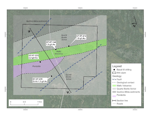
FIGURE 2: PROPERTY GEOLOGY
There are no active mining operations within close proximity to the Duc Project. Agrium Inc’s phosphate mine is 10km east of the project area. The Kapuskasing mine ranks as one of the highest-grade phosphate mines in the world (Clark and Duncan, 1999). Apatite is the principal ore mineral mined at the Kapuskasing Phosphate Operations. The Agrium mine area is now being explored for its Rare Earth Element potential.
RIVERSIDE EXPLORATION WORK
Riverside’s first phase of work included prospecting and sampling. The recent work confirmed two previously identified areas of mineralized exposures. There are two predominant target orientations on the project: (1) east-west shears often related to terrain boundaries and fault bounded contact zones; and (2) intrusive fault bounded or faulted peridotite units that manifest as magnetic highs and show high PGE soil geochemical anomalies.
In 2023 the Company contracted SHA Geophysics using their Heli-3G, 3-axis magnetic gradiometer system completing line spacing of 75m and a total of 112-line kilometers of survey. This type of helicopter survey uses SHA’s latest technology and sensors to get clean and consistent data.
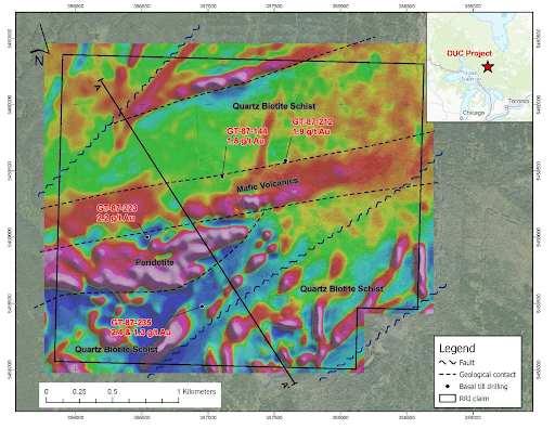
FIGURE 3 FIRST VERTICAL DERIVATIVE, HELI-3G MAGNETICS SURVEY WITH INTERPRETED GEOLOGY
The vertical gradient accentuates shorter wavelengths and attenuates longer wavelengths. As a result, the map enhances the anomalies associated with small near-surface magnetic sources while suppressing large-scale regional variations. The vertical gradient presentation provides added visual detail, particularly for small anomalies superimposed on or adjacent to larger anomalies.
The next phase of exploration will include ground geophysics over the areas identified during prospecting and defined by the magnetics survey. The work will focus on gold and PGE exploration.
Project Geology
The Project is underlain by Archean-aged metavolcanic and metasedimentary rocks consisting of greywacke, arkose, and iron formation similar to the rocks known to host known gold deposits. To the west and north, the terrain is underlain by east-west striking metasedimentary schists and mafic metavolcanic flows belonging to the Quetico Subprovince. The south and east areas of the Project are underlain by hornblende-quartz feldspar gneiss and granite bodies belonging to the Wawa Subprovince. The Project also lies within the LePage Fault System. This system is part of the western margin of the KSZ and consists of a series of parallel northeast trending fault structures, which include the Rufus Lake and Opasatika Lake faults. Both faults cross the property and are easily identifiable on the regional government airborne magnetic survey sheets. Assuming these structural could be potential feeders the Company sees high prospectivity for discoveries of mineralization associated with past tectonic- magmatic evolution.
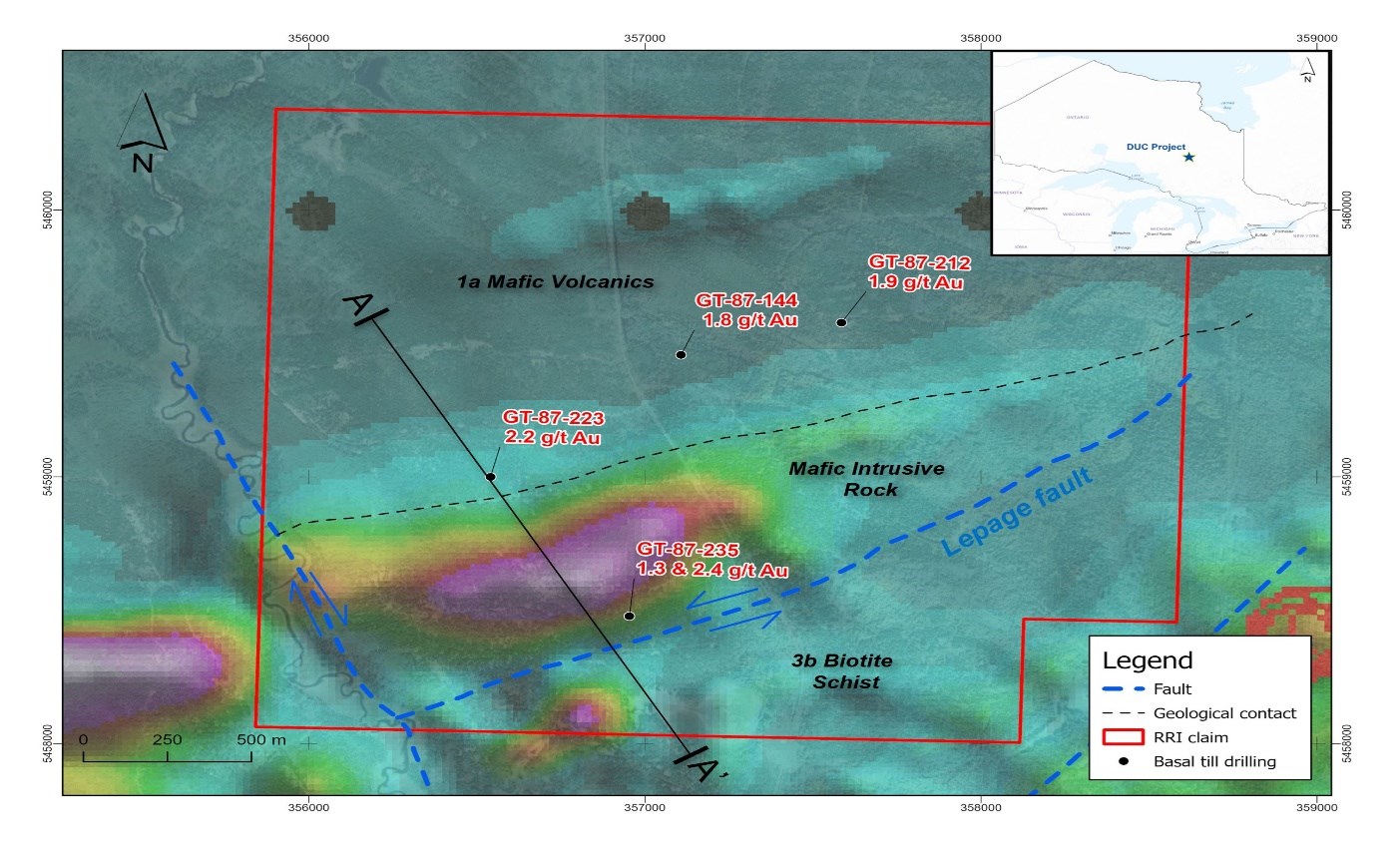
Figure 1: Geology superimposed on regional airborne mag
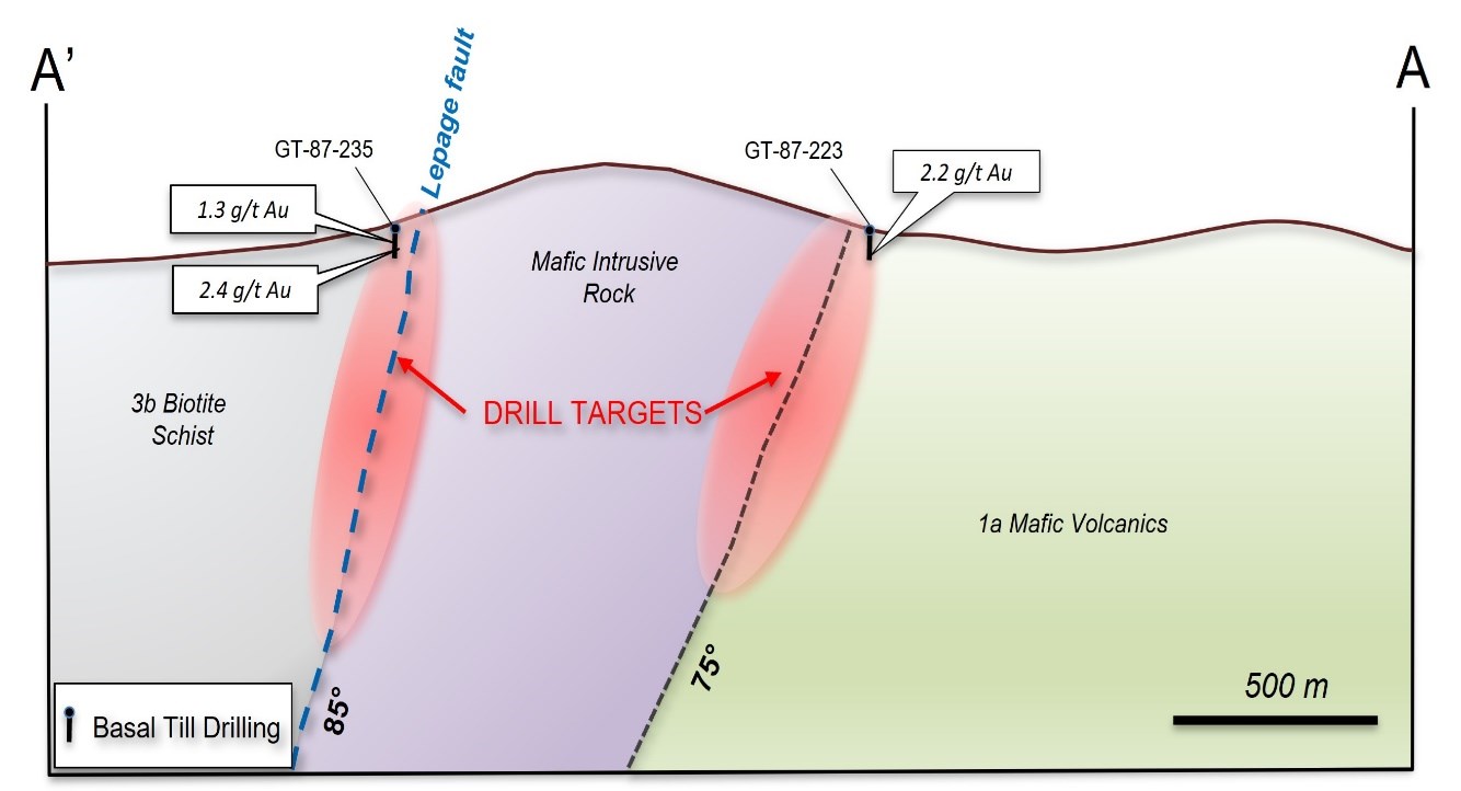
Figure 2: Simplified Cross Section
Targets
The next phase of proposed exploration includes ground-based geophysics building upon previous work to further refine the larger structures likely responsible for gold mineralization in the area. Past work included sonic drilling and basal till sampling which may be needed in areas of thick cover.
Project History
The Duc Project (“the Project”), located south of the town of Kapuskasing, within the Porcupine Mining District. The Project is roughly 600 hectares in size. The area has excellent infrastructure, with road access from the Trans-Canada Highway and only 10km from the past- producing Agrium Ltd. Mine. The Project also has nearby existing power and within a 40-minute drive from the town of Kapuskasing (pop. 8,300).
Interest in Ontario’s critical minerals sector has attracted new explorers to this region, which in our opinion can open up this area further to development through its rare earth element potential, along with the known gold endowment.